


New Grant Benefits Museum’s Historic Map Collection
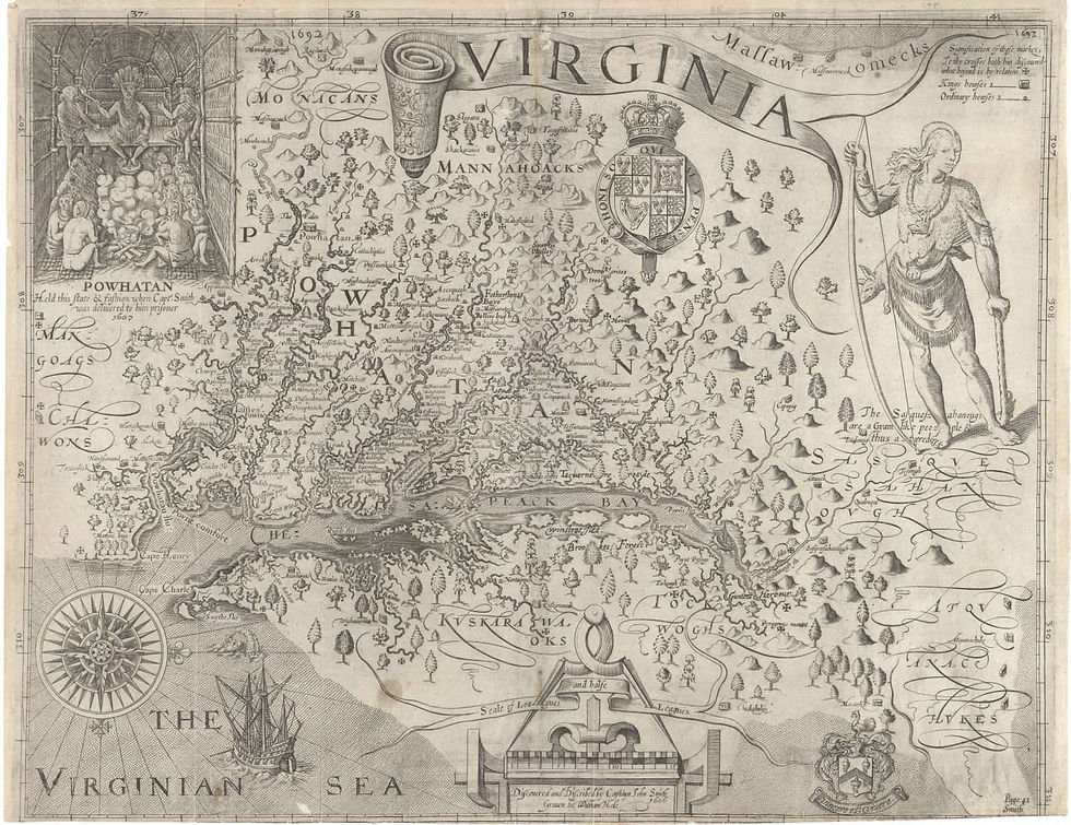
Captain John Smith visited our area in 1608 as he traveled around the Chesapeake Bay region. He and his crew took laborious notes, made drawings and sketches, and captured the most detail-oriented facts about our local Native life as recorded up to that time. All was combined to create a map published in 1612 which became known as the John Smith Map. It is a fundamental building block in our map collection here at the museum.
Nova Virginiae Tabula drawn by Henricus Hondius is a 1630 map of the Virginia Colony and the Chesapeake Bay. Oriented to the West, this map covers from Cape Henry to the Susquehanna River and inland as far as the Appalachian Mountains. The Chesapeake Bay is shown in full as are many of its river estuaries.
Another early map, Virginia and Maryland As it is Planted and Inhabited this present Year
1670 was drawn and researched by cartographer Augustine Herrman. We have a beautiful copy of this map that is helpful in the understanding of how the Chesapeake region grew early in its settlement.
The Fry-Jefferson Map, first published in the summer of 1753, depicts the waters and shorelines, mountains, early county divisions and settlements up to that point in the Colony of Virginia. It was drawn by cartographer and surveyors Joshua Fry and Peter Jefferson (who was the father of Thomas Jefferson, another local Virginian).
Our museum has spent the past 15 years pulling together historical maps that include Middlesex County in their depictions. We use them in our educational outreach to the schools that visit the museum, but all are also available to the general public. Through a variety of grants, we have developed hands-on learning materials that meet the SOL history curriculum requirements for the state of Virginia. These materials were created to enhance the viewing and interaction of students with our exhibits: puzzles, scavenger hunts, word searches, worksheets, and games.
Dominion Energy recently awarded the Museum a generous grant to develop our mapping collection and worksheet collection into an educational materials station placed in the floor plan of the museum. We are currently in the final stages of making this station a reality and will soon have our materials available to our locals who stop by with their grandchildren or the many tourists that visit the campgrounds during family vacations.
Our large collection of historical maps that include Middlesex County from the 1500s through the 1900s, will now be housed in a five-drawer map case. Two free standing cases of multiple slots for worksheet materials will be divided into time frames that correlate to the divisions within the museum itself. This will allow visitors to quickly find materials by theme, say for WWI verses Native Americans.
Also included are two long rectangular table with chairs for a workspace to spread both the maps and papers out to work with them. Writing utensils as well as clipboards and magnifying glasses will give visitors supportive access to their museum explorations, and a storage area will keep all organized.


Comments